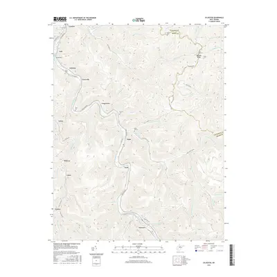
2016 Map of Sylvester
USGS Topo · Published 2016About this map
Sylvester and its neighboring coal towns define the deep valleys of Boone and Kanawha counties in this 2016 survey. The Big Coal River serves as the primary corridor for movement, followed closely by the winding Coal River Rd and the rail line that serves the valley floor. Small settlements like Prenter, Seth, and Orgas are tucked into the narrow hollows where tributaries like Hopkins Fork and White Oak Cr meet the river. Genealogy researchers will find significant value in the distribution of family and community burial grounds, including the White Oak Cem, Foster Cem, and Pettry Cem, which sit on the high ground above the residential clusters. The terrain is marked by distinct elevations such as Branham S Hts and Dawes Mountain Rd, illustrating the vertical nature of life in the southern West Virginia coalfields.
Find a feature on this map
68 named features on this map. Tap any name to fly to it.
Don’t see what you’re looking for? This feature index may not catch every label — zoom into the map to look around manually.
Map Details
Editions of this 2016 Sylvester Map
This is the sole edition of this map. No revisions or reprints were ever made.
Other maps of this area

1891 · Oceana
USGS Topo · 1:125,000

1891 · Raleigh
USGS Topo · 1:125,000

1893 · Oceana
USGS Topo · 1:125,000

1897 · Kanawha Falls
USGS Topo · 1:125,000

1897 · Raleigh
USGS Topo · 1:125,000

1898 · Oceana
USGS Topo · 1:125,000

1899 · Charleston
USGS Topo · 1:125,000

1900 · Kanawha Falls
USGS Topo · 1:125,000

1901 · Kanawha Falls
USGS Topo · 1:125,000

1902 · Raleigh
USGS Topo · 1:125,000