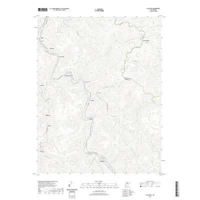
2019 Map of Sylvester
USGS Topo · Published 2019About this map
The Big Coal River carves a winding path through this corner of Boone County, anchoring a series of valley settlements connected by the Walhonde Water Trail. This 2019 survey documents the enduring community layouts of Seth, Sylvester, and Prenter, where the narrow bottomlands dictate the placement of homes and infrastructure like the Seth Bridge. The landscape is defined by its deep drainage networks, with numerous branches such as White-Oak Cr and Spruce Fork feeding the main river system.
Find a feature on this map
70 named features on this map. Tap any name to fly to it.
Don’t see what you’re looking for? This feature index may not catch every label — zoom into the map to look around manually.
Map Details
Editions of this 2019 Sylvester Map
This is the sole edition of this map. No revisions or reprints were ever made.
Other maps of this area

1891 · Oceana
USGS Topo · 1:125,000

1891 · Raleigh
USGS Topo · 1:125,000

1893 · Oceana
USGS Topo · 1:125,000

1897 · Kanawha Falls
USGS Topo · 1:125,000

1897 · Raleigh
USGS Topo · 1:125,000

1898 · Oceana
USGS Topo · 1:125,000

1899 · Charleston
USGS Topo · 1:125,000

1900 · Kanawha Falls
USGS Topo · 1:125,000

1901 · Kanawha Falls
USGS Topo · 1:125,000

1902 · Raleigh
USGS Topo · 1:125,000