
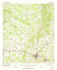
1956 Map of Sylvester
USGS Topo · Published 1958About this map
The railroad and highway corridor connecting Sylvester and Poulan anchors this mid-century survey of Worth County. The Atlantic Coast Line railroad runs parallel to the Veterans Memorial Highway, tracing a path through the heart of the region's agricultural landscape. The presence of numerous rural schools and houses of worship, such as Porters Corner Sch, Morning Star Ch, and Providence Ch, reflects a deeply rooted community structure.
Find a feature on this map
68 named features on this map. Tap any name to fly to it.
Don’t see what you’re looking for? This feature index may not catch every label — zoom into the map to look around manually.
Map Details
Editions of this 1956 Sylvester Map
2 editions found
Other maps of this area

1953 · Dothan
USGS Topo · 1:250,000

1953 · Waycross
USGS Topo · 1:250,000

1954 · Dothan
USGS Topo · 1:250,000

1955 · Dothan
USGS Topo · 1:250,000

1956 · Albany East
USGS Topo · 1:24,000

1956 · Baconton
USGS Topo · 1:62,500

1956 · Doerun
USGS Topo · 1:62,500

1956 · Albany
USGS Topo · 1:62,500

1956 · Leslie
USGS Topo · 1:62,500

1958 · Waycross
USGS Topo · 1:250,000