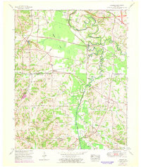
1951 Map of Symsonia
USGS Topo · Published 1969About this map
Clarks River snakes through the heart of the Kentucky countryside, marking the boundary where McCracken County meets Graves County. This mid-century survey captures a network of small agricultural settlements and crossroads that defined the region before modern expansion. The town of Symsonia serves as a local hub, supported by a landscape dotted with numerous small country churches and family burial grounds like Boaz Cem and Switzer Cem.
Find a feature on this map
58 named features on this map. Tap any name to fly to it.
Don’t see what you’re looking for? This feature index may not catch every label — zoom into the map to look around manually.
Map Details
Editions of this 1951 Symsonia Map
2 editions found
Other maps of this area

1926 · Paducah
USGS Topo · 1:62,500

1929 · Smithland
USGS Topo · 1:62,500

1929 · Paducah
USGS Topo · 1:62,500

1936 · Melber
USGS Topo · 1:24,000

1936 · Paducah
USGS Topo · 1:24,000

1936 · Oak Level
USGS Topo · 1:24,000

1936 · Elva
USGS Topo · 1:24,000

1936 · Smithland
USGS Topo · 1:48,000

1936 · Symsonia
USGS Topo · 1:24,000

1936 · Benton
USGS Topo · 1:48,000