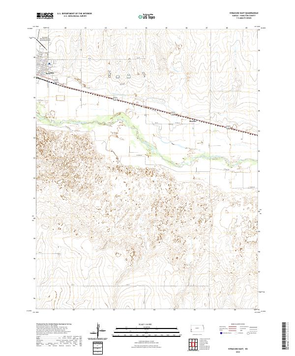
2022 Map of Syracuse East
USGS Topo · Published 2022About this map
Syracuse serves as the primary hub on this Hamilton County landscape, where the street grid of Avenue E and Barton St meets the agricultural and transportation corridors of the western Kansas plains. The Arkansas River divides the terrain, flanked by irrigation infrastructure like the Fort Aubrey Ditch, which reflects the region's long-standing reliance on water management for prairie farming. To the east, the small siding of Mayline sits along the transit lines that parallel the river valley. The map documents the relationship between the modern Syracuse-Hamilton County Municipal Airport and the surrounding rural sections. Farther north, Sand Cr cuts through the higher elevations, while a network of rural routes such as E River Rd provides access to the river bottomlands south of the city center.
Find a feature on this map
29 named features on this map. Tap any name to fly to it.
Don’t see what you’re looking for? This feature index may not catch every label — zoom into the map to look around manually.
Map Details
Editions of this 2022 Syracuse East Map
This is the sole edition of this map. No revisions or reprints were ever made.
Other maps of this area

1900 · Syracuse
USGS Topo · 1:125,000

1920 · Syracuse
USGS Topo · 1:125,000

1955 · Dodge City
USGS Topo · 1:250,000

1955 · Scott City
USGS Topo · 1:250,000

1958 · Dodge City
USGS Topo · 1:250,000

1958 · Scott City
USGS Topo · 1:250,000

1959 · Dodge City
USGS Topo · 1:250,000

1966 · Syracuse East SW
USGS Topo · 1:24,000

1966 · Syracuse East
USGS Topo · 1:24,000
1966 · Syracuse West SE
USGS Topo · 1:24,000