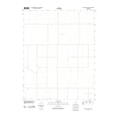
2010 Map of Syracuse East SW
USGS Topo · Published 2010About this map
Agricultural patterns and a rigid section-line grid characterize this 2010 survey of Hamilton County. The landscape is defined by its infrastructure, where a network of gravel and dirt routes like Rd 31 and Road S provide the primary access to the expansive high plains. The transition of routes, such as the bend of Rd 33 and the southern reach of Co Rd T, indicates the practical requirements of land management and transportation in this sparsely populated region of western Kansas. This survey captures the rural layout before modern developments might alter the traditional farm-to-market paths that have served the county for generations.
Find a feature on this map
16 named features on this map. Tap any name to fly to it.
Don’t see what you’re looking for? This feature index may not catch every label — zoom into the map to look around manually.
Map Details
Editions of this 2010 Syracuse East SW Map
This is the sole edition of this map. No revisions or reprints were ever made.
Other maps of this area

1900 · Syracuse
USGS Topo · 1:125,000

1920 · Syracuse
USGS Topo · 1:125,000

1955 · Dodge City
USGS Topo · 1:250,000

1958 · Dodge City
USGS Topo · 1:250,000

1959 · Dodge City
USGS Topo · 1:250,000

1959 · Big Bow NE
USGS Topo · 1:24,000

1959 · Big Bow NW
USGS Topo · 1:24,000

1966 · Syracuse East SW
USGS Topo · 1:24,000

1966 · Syracuse East
USGS Topo · 1:24,000
1966 · Syracuse West SE
USGS Topo · 1:24,000