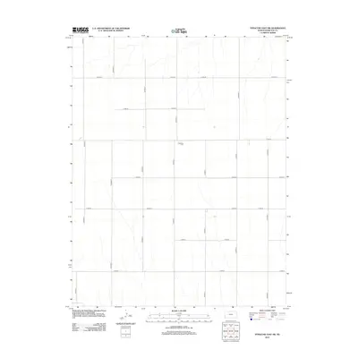
2012 Map of Syracuse East SW
USGS Topo · Published 2012About this map
The Ebenfleur Cem stands as a solitary landmark within this grid-defined portion of Hamilton County. This 2012 survey reveals a landscape almost entirely shaped by the Public Land Survey System, where a rigid network of county roads, such as CO Road S and CO Road-32, dictates the movement across the high plains. The terrain is characterized by subtle drainage patterns that cross these linear boundaries, illustrating the intersection of natural hydrology and human-imposed order. The lack of concentrated settlements or named towns in this specific area highlights its agricultural character, where local history is preserved in small, family-named landmarks and the vast connective tissue of the rural road system including CO Road Q and CO Road-35.
Find a feature on this map
15 named features on this map. Tap any name to fly to it.
Don’t see what you’re looking for? This feature index may not catch every label — zoom into the map to look around manually.
Map Details
Editions of this 2012 Syracuse East SW Map
This is the sole edition of this map. No revisions or reprints were ever made.
Other maps of this area

1900 · Syracuse
USGS Topo · 1:125,000

1920 · Syracuse
USGS Topo · 1:125,000

1955 · Dodge City
USGS Topo · 1:250,000

1958 · Dodge City
USGS Topo · 1:250,000

1959 · Dodge City
USGS Topo · 1:250,000

1959 · Big Bow NE
USGS Topo · 1:24,000

1959 · Big Bow NW
USGS Topo · 1:24,000

1966 · Syracuse East SW
USGS Topo · 1:24,000

1966 · Syracuse East
USGS Topo · 1:24,000
1966 · Syracuse West SE
USGS Topo · 1:24,000