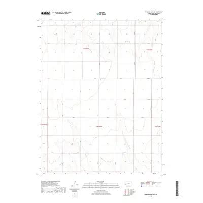
2018 Map of Syracuse East SW
USGS Topo · Published 2018About this map
The High Plains of western Kansas are defined by a geometric grid of rural routes and sectional boundaries in this 2018 survey of Hamilton County. The landscape is characterized by intermittent drainages and subtle shifts in elevation, with the township lines of t25s r40w and t26s r40w organizing the vast agricultural and grazing lands. A significant point of local history is found at the Ebenfleur Cem, which sits near the intersection of Rd 31 and Rd S. The transportation network is strictly utilitarian, composed of a series of county roads like Co Rd U and Co Rd V that facilitate movement across the prairie. This map provides a precise record of the modern land divisions and rural infrastructure that continue to shape the region's ranching economy.
Find a feature on this map
25 named features on this map. Tap any name to fly to it.
Don’t see what you’re looking for? This feature index may not catch every label — zoom into the map to look around manually.
Map Details
Editions of this 2018 Syracuse East SW Map
This is the sole edition of this map. No revisions or reprints were ever made.
Other maps of this area

1900 · Syracuse
USGS Topo · 1:125,000

1920 · Syracuse
USGS Topo · 1:125,000

1955 · Dodge City
USGS Topo · 1:250,000

1958 · Dodge City
USGS Topo · 1:250,000

1959 · Dodge City
USGS Topo · 1:250,000

1959 · Big Bow NE
USGS Topo · 1:24,000

1959 · Big Bow NW
USGS Topo · 1:24,000

1966 · Syracuse East SW
USGS Topo · 1:24,000

1966 · Syracuse East
USGS Topo · 1:24,000
1966 · Syracuse West SE
USGS Topo · 1:24,000