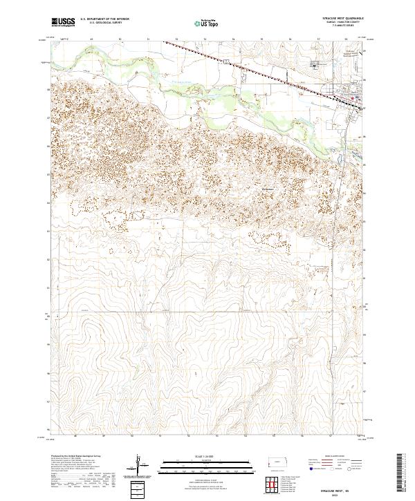
2022 Map of Syracuse West
USGS Topo · Published 2022About this map
The Arkansas River carves a critical path across this western Kansas landscape, where water management and agriculture define the local geography. The town of Syracuse serves as the regional hub, anchored by the Hamilton County Courthouse and a grid of streets that includes historical thoroughfares like Santa Fe Rd and Main St. Outside the town center, the Fort Aubrey Ditch indicates the longstanding importance of irrigation in this semi-arid region, drawing from the river to support the surrounding plains. The terrain is marked by seasonal drainages like Dry Cr and Syracuse Cr, which cut through the open land north and south of the river valley. To the northeast, the Syracuse Cem and the Syracuse- Hamilton County Municipal Airport stand at the edge of the residential community, marking the transition from town life to the expansive rural sections of Hamilton County.
Find a feature on this map
31 named features on this map. Tap any name to fly to it.
Don’t see what you’re looking for? This feature index may not catch every label — zoom into the map to look around manually.
Map Details
Editions of this 2022 Syracuse West Map
This is the sole edition of this map. No revisions or reprints were ever made.
Other maps of this area

1900 · Syracuse
USGS Topo · 1:125,000

1920 · Syracuse
USGS Topo · 1:125,000

1955 · Dodge City
USGS Topo · 1:250,000

1955 · Scott City
USGS Topo · 1:250,000

1958 · Dodge City
USGS Topo · 1:250,000

1958 · Scott City
USGS Topo · 1:250,000

1959 · Dodge City
USGS Topo · 1:250,000

1966 · Syracuse West SW
USGS Topo · 1:24,000

1966 · Syracuse East SW
USGS Topo · 1:24,000
1966 · Tribune 3 SW
USGS Topo · 1:24,000