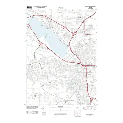
2010 Map of Syracuse West
USGS Topo · Published 2010About this map
Onondaga Lake dominates this central New York landscape, surrounded by a dense network of suburban and industrial development. The shoreline features unique historical and transportation markers, including the Fort Sainte Marie De Gannentaha and the Onondaga Lake Seaplane Base. To the southeast, the urban fabric of Syracuse transitions into academic and institutional grounds at Syracuse University and the State University of New York Upstate Medical University.
Find a feature on this map
70 named features on this map. Tap any name to fly to it.
Don’t see what you’re looking for? This feature index may not catch every label — zoom into the map to look around manually.
Map Details
Editions of this 2010 Syracuse West Map
This is the sole edition of this map. No revisions or reprints were ever made.
Other maps of this area

1895 · Syracuse
USGS Topo · 1:62,500

1898 · Syracuse
USGS Topo · 1:62,500

1899 · Skaneateles
USGS Topo · 1:62,500

1900 · Baldwinsville
USGS Topo · 1:62,500

1900 · Tully
USGS Topo · 1:62,500

1902 · Skaneateles
USGS Topo · 1:62,500

1938 · Syracuse East
USGS Topo · 1:24,000

1939 · Syracuse West
USGS Topo · 1:24,000

1940 · Brewerton
USGS Topo · 1:24,000

1940 · Cicero
USGS Topo · 1:24,000