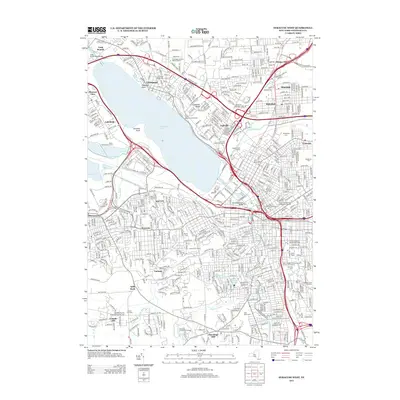
2013 Map of Syracuse West
USGS Topo · Published 2013About this map
Onondaga Lake serves as the central focal point for this urban and suburban landscape, surrounded by a dense network of residential communities and institutional landmarks. The map documents the extensive footprint of Syracuse University, including the iconic Carrier Dome and J. Stanley Coyne Stadium, alongside the SUNY College of Environmental Science and Forestry. Significant historical and cultural sites are scattered throughout the region, from the commemorative Fort Sainte Marie de Gannentaha on the lake's eastern shore to the numerous hilltop cemeteries like Oakwood Cemetery and Rose Hill Cemetery. The infrastructure reflects a complex integration of water management and transportation, featuring the Westcott Reservoir and Woodland Reservoir, the CSX rail lines, and the Onondaga Creek Bridge. Communities such as Liverpool, Solvay, and Galeville wrap around the water, while Onondaga Community College occupies the higher ground to the southwest at Onondaga Hill.
Find a feature on this map
537 named features on this map. Tap any name to fly to it.
Don’t see what you’re looking for? This feature index may not catch every label — zoom into the map to look around manually.
Map Details
Editions of this 2013 Syracuse West Map
This is the sole edition of this map. No revisions or reprints were ever made.
Other maps of this area

1895 · Syracuse
USGS Topo · 1:62,500

1898 · Syracuse
USGS Topo · 1:62,500

1899 · Skaneateles
USGS Topo · 1:62,500

1900 · Baldwinsville
USGS Topo · 1:62,500

1900 · Tully
USGS Topo · 1:62,500

1902 · Skaneateles
USGS Topo · 1:62,500

1938 · Syracuse East
USGS Topo · 1:24,000

1939 · Syracuse West
USGS Topo · 1:24,000

1940 · Brewerton
USGS Topo · 1:24,000

1940 · Cicero
USGS Topo · 1:24,000