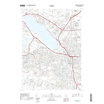
2019 Map of Syracuse West
USGS Topo · Published 2019About this map
Onondaga Lake dominates the central landscape of this 2019 survey, serving as the geographic anchor for the surrounding urban and suburban developments of Central New York. The map reveals the dense settlement patterns of Syracuse and Solvay, while highlighting major institutional footprints such as Syracuse University and the SUNY College of Environmental Science and Forestry. The infrastructure of the era is evident in the complex highway network and the presence of the CSX rail line, showing how transportation corridors have shaped the growth of communities like Liverpool and Galeville.
Find a feature on this map
68 named features on this map. Tap any name to fly to it.
Don’t see what you’re looking for? This feature index may not catch every label — zoom into the map to look around manually.
Map Details
Editions of this 2019 Syracuse West Map
This is the sole edition of this map. No revisions or reprints were ever made.
Other maps of this area

1895 · Syracuse
USGS Topo · 1:62,500

1898 · Syracuse
USGS Topo · 1:62,500

1899 · Skaneateles
USGS Topo · 1:62,500

1900 · Baldwinsville
USGS Topo · 1:62,500

1900 · Tully
USGS Topo · 1:62,500

1902 · Skaneateles
USGS Topo · 1:62,500

1938 · Syracuse East
USGS Topo · 1:24,000

1939 · Syracuse West
USGS Topo · 1:24,000

1940 · Brewerton
USGS Topo · 1:24,000

1940 · Cicero
USGS Topo · 1:24,000