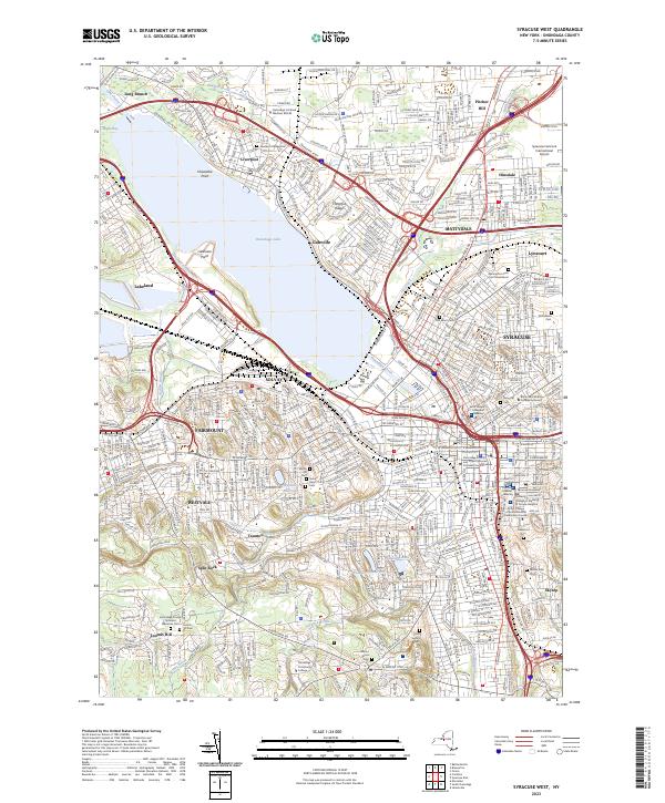
2023 Map of Syracuse West
USGS Topo · Published 2023About this map
Onondaga Lake anchors this detailed modern survey of the western Syracuse metropolitan area, capturing the dense intersection of transit, industry, and institutional expansion. The urban footprint of Syracuse and Solvay is balanced by numerous preserved spaces and historic grounds, including the extensive Oakwood Cem and Rose Hill Cem. Educational and medical institutions such as Syracuse University, Upstate Medical University, and the SUNY College of Environmental Science and Forestry occupy prominent positions in the city's east, while Onondaga Community College sits to the southwest.
Find a feature on this map
62 named features on this map. Tap any name to fly to it.
Don’t see what you’re looking for? This feature index may not catch every label — zoom into the map to look around manually.
Map Details
Editions of this 2023 Syracuse West Map
This is the sole edition of this map. No revisions or reprints were ever made.
Other maps of this area

1895 · Syracuse
USGS Topo · 1:62,500

1898 · Syracuse
USGS Topo · 1:62,500

1899 · Skaneateles
USGS Topo · 1:62,500

1900 · Baldwinsville
USGS Topo · 1:62,500

1900 · Tully
USGS Topo · 1:62,500

1902 · Skaneateles
USGS Topo · 1:62,500

1938 · Syracuse East
USGS Topo · 1:24,000

1939 · Syracuse West
USGS Topo · 1:24,000

1940 · Brewerton
USGS Topo · 1:24,000

1940 · Cicero
USGS Topo · 1:24,000