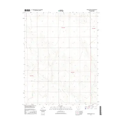
2015 Map of Syracuse West SE
USGS Topo · Published 2015About this map
Intermittent stream beds and a strictly ordered grid of section lines define this high-plains landscape in Hamilton County during the mid-2010s. The terrain is marked by the seasonal drainage of N Bear Cr and Little Bear Cr, which carve subtle paths through the flat agricultural and grazing lands of western Kansas. The human footprint here is primarily a network of rural routes, including Rd J, Rd 31, and Rd 34, which follow the township and range boundaries established by the Public Land Survey System. This document reflects the enduring geometry of the American West, where large-scale land management is dictated by the precise coordinates of the survey grid. The sparse distribution of named features underscores the rural character of this region, where life and labor are organized around the natural flow of seasonal creeks and the straight lines of the county road system.
Find a feature on this map
14 named features on this map. Tap any name to fly to it.
Don’t see what you’re looking for? This feature index may not catch every label — zoom into the map to look around manually.
Map Details
Editions of this 2015 Syracuse West SE Map
This is the sole edition of this map. No revisions or reprints were ever made.
Other maps of this area

1900 · Syracuse
USGS Topo · 1:125,000

1920 · Syracuse
USGS Topo · 1:125,000

1955 · Dodge City
USGS Topo · 1:250,000

1958 · Dodge City
USGS Topo · 1:250,000

1959 · Dodge City
USGS Topo · 1:250,000

1959 · Big Bow NW
USGS Topo · 1:24,000

1966 · Syracuse West SW
USGS Topo · 1:24,000

1966 · Syracuse East SW
USGS Topo · 1:24,000

1966 · Syracuse East
USGS Topo · 1:24,000
1966 · Syracuse West SE
USGS Topo · 1:24,000