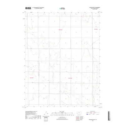
2018 Map of Syracuse West SE
USGS Topo · Published 2018About this map
N Bear Cr and Little Bear Cr define the subtle drainage patterns across this High Plains landscape in western Kansas. The terrain is characterized by the structured grid of the Public Land Survey System, with boundaries such as t26s r41w and t25s r41w organizing the rural acreage. This 2018 survey reflects the persistent agrarian nature of the region, where the primary infrastructure consists of an extensive network of section-line roads, including Rd J, Rd 31, and Rd 34. The sparse settlement pattern highlights the vast distances of Hamilton County, where small seasonal waterways are the most prominent geographic landmarks among the agricultural blocks.
Find a feature on this map
14 named features on this map. Tap any name to fly to it.
Don’t see what you’re looking for? This feature index may not catch every label — zoom into the map to look around manually.
Map Details
Editions of this 2018 Syracuse West SE Map
This is the sole edition of this map. No revisions or reprints were ever made.
Other maps of this area

1900 · Syracuse
USGS Topo · 1:125,000

1920 · Syracuse
USGS Topo · 1:125,000

1955 · Dodge City
USGS Topo · 1:250,000

1958 · Dodge City
USGS Topo · 1:250,000

1959 · Dodge City
USGS Topo · 1:250,000

1959 · Big Bow NW
USGS Topo · 1:24,000

1966 · Syracuse West SW
USGS Topo · 1:24,000

1966 · Syracuse East SW
USGS Topo · 1:24,000

1966 · Syracuse East
USGS Topo · 1:24,000
1966 · Syracuse West SE
USGS Topo · 1:24,000