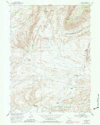
1953 Map of T E Ranch
USGS Topo · Published 1983About this map
The Shirley Mountains and Bald Mountain dominate this mid-century landscape in Carbon County, where high-altitude ranching and water management define the settlement pattern. Isolated family operations such as the Walsh Ranch, Watkins Ranch, and Campbell Ranch are situated along the drainages of Troublesome Creek and Mud Creek. A notable genealogical detail is the Maynard Homestead (Aband) near the headwaters of Cottonwood Creek, providing a record of early attempts at high-country settlement. Irrigation infrastructure, including the Nelson Ditch and Ditch networks, underscores the vital importance of water rights in this arid environment. To the south, the terrain descends toward the Medicine Bow River and the deeply eroded Medicine Bow Breaks, where a Gaging Sta monitors the river's flow. This survey reveals a landscape of enduring ranching traditions, where place names like Smith Park and T E Ranch denote the deep-seated presence of established cattle and sheep operations.
Find a feature on this map
33 named features on this map. Tap any name to fly to it.
Don’t see what you’re looking for? This feature index may not catch every label — zoom into the map to look around manually.
Map Details
Editions of this 1953 T E Ranch Map
3 editions found
Other maps of this area

1893 · Fort Steele
USGS Topo · 1:125,000

1914 · Hanna
USGS Topo · 1:62,500

1914 · Saddleback Hills
USGS Topo · 1:62,500

1921 · Saddleback Hills
USGS Topo · 1:62,500

1953 · Schneider Ridge
USGS Topo · 1:24,000

1953 · The Q Ranch
USGS Topo · 1:24,000

1953 · T E Ranch
USGS Topo · 1:24,000

1953 · Beaver Creek
USGS Topo · 1:24,000

1954 · Rawlins
USGS Topo · 1:250,000

1955 · Casper
USGS Topo · 1:250,000