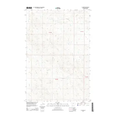
2014 Map of T G Creek
USGS Topo · Published 2014About this map
O'Fallon Cr and T G Cr wind through this corner of Fallon County, Montana, defining a landscape of high plains drainage systems. In this rural section of the state, the geography is marked by the branching tributaries of Pine Cr and Timber Cr, which carve through the terrain under the administration of the Public Land Survey System townships of t7n r56e and t6n r56e. The network of local routes like Pine Creek Rd and Hay Creek Rd provides the primary infrastructure for the region's ranching or agricultural operations. A notable cultural or historical landmark is the Dog Town Trl in the northern portion of the map, suggesting localized names for historical routes or areas of ecological interest. The map serves as a clear record of the watershed patterns and land divisions in the remote eastern Montana territory during the early twenty-first century.
Find a feature on this map
12 named features on this map. Tap any name to fly to it.
Don’t see what you’re looking for? This feature index may not catch every label — zoom into the map to look around manually.
Map Details
Editions of this 2014 T G Creek Map
This is the sole edition of this map. No revisions or reprints were ever made.
Other maps of this area

1953 · Miles City
USGS Topo · 1:250,000

1957 · Miles City
USGS Topo · 1:250,000

1958 · Miles City
USGS Topo · 1:250,000

1981 · Baker
USGS Topo · 1:100,000

1981 · Harmon Butte
USGS Topo · 1:24,000

1981 · Nelson Butte
USGS Topo · 1:24,000

1981 · Little Pine Creek
USGS Topo · 1:24,000

1981 · Bracket Butte SE
USGS Topo · 1:24,000

1981 · Seven-Up Butte
USGS Topo · 1:24,000
1981 · Plevna
USGS Topo · 1:24,000