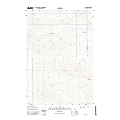
2017 Map of T G Creek
USGS Topo · Published 2017About this map
O'Fallon Cr and its tributaries carve a network of drainages through this portion of Fallon County, defining a landscape dominated by intermittent watercourses and expansive prairie. The map shows a region organized by the Public Land Survey System, with township lines for t7n r56e and t6n r57e providing the primary structure for movement and land management. Human presence is marked by low-density infrastructure, including the curiously named Dog Town Trl and Pine Creek Rd, which provide access across the high ground between Timber Cr and T G Cr. This 2017 survey reflects the enduring rural character of eastern Montana, where the terrain is dictated more by the path of Brush Cr and Pine Cr than by urban development.
Find a feature on this map
11 named features on this map. Tap any name to fly to it.
Don’t see what you’re looking for? This feature index may not catch every label — zoom into the map to look around manually.
Map Details
Editions of this 2017 T G Creek Map
This is the sole edition of this map. No revisions or reprints were ever made.
Other maps of this area

1953 · Miles City
USGS Topo · 1:250,000

1957 · Miles City
USGS Topo · 1:250,000

1958 · Miles City
USGS Topo · 1:250,000

1981 · Baker
USGS Topo · 1:100,000

1981 · Harmon Butte
USGS Topo · 1:24,000

1981 · Nelson Butte
USGS Topo · 1:24,000

1981 · Little Pine Creek
USGS Topo · 1:24,000

1981 · Bracket Butte SE
USGS Topo · 1:24,000

1981 · Seven-Up Butte
USGS Topo · 1:24,000
1981 · Plevna
USGS Topo · 1:24,000