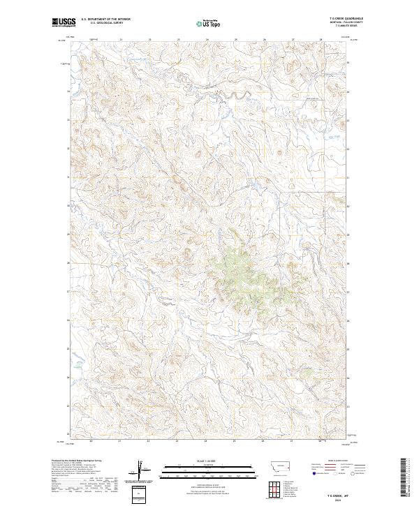
2024 Map of T G Creek
USGS Topo · Published 2024About this map
O'fallon Creek and its numerous tributaries dominate this southeastern Montana landscape, revealing a complex drainage system that has shaped the local topography of Fallon County. The area is defined by intermittent waterways, including the namesake T G Creek and the meandering Pine Creek, which carve through the high plains and break up the terrain into distinct ridges and coulees. Small sections of woodland are visible near the central drainages, offering a rare break in the open range.
Find a feature on this map
11 named features on this map. Tap any name to fly to it.
Don’t see what you’re looking for? This feature index may not catch every label — zoom into the map to look around manually.
Map Details
Editions of this 2024 T G Creek Map
This is the sole edition of this map. No revisions or reprints were ever made.
Other maps of this area

1953 · Miles City
USGS Topo · 1:250,000

1957 · Miles City
USGS Topo · 1:250,000

1958 · Miles City
USGS Topo · 1:250,000

1981 · Baker
USGS Topo · 1:100,000

1981 · Harmon Butte
USGS Topo · 1:24,000

1981 · Nelson Butte
USGS Topo · 1:24,000

1981 · Little Pine Creek
USGS Topo · 1:24,000

1981 · Bracket Butte SE
USGS Topo · 1:24,000

1981 · Seven-Up Butte
USGS Topo · 1:24,000
1981 · Plevna
USGS Topo · 1:24,000