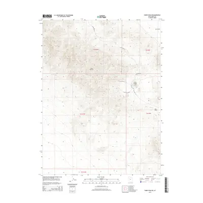
2014 Map of Tabbys Peak SW
USGS Topo · Published 2014About this map
Cedar Mountains dominate this arid landscape, showing the complex topography of the Great Basin in western Utah. The map documents a network of isolated water sources essential for survival in this environment, including Cane Springs, Bitter Spring, and White Rock Spring. To the east, the terrain descends into Skull Valley, a region of significant historical and geologic interest. Primitive transportation routes like Cochran Spring Rd and Post Hollow Rd trace the contours of the land, connecting landmarks such as the prominent White Rock and the drainage of Wide Hollow. This detailed 2014 survey serves as a modern baseline for understanding the unchanged character of these mountain ridges and the distribution of scarce water resources within the Public Land Survey System grids of T5S, T6S, and T7S.
Find a feature on this map
16 named features on this map. Tap any name to fly to it.
Don’t see what you’re looking for? This feature index may not catch every label — zoom into the map to look around manually.
Map Details
Editions of this 2014 Tabbys Peak SW Map
This is the sole edition of this map. No revisions or reprints were ever made.
Other maps of this area

1885 · Tooele Valley
USGS Topo · 1:250,000

1953 · Tooele
USGS Topo · 1:250,000

1954 · Dugway Proving Ground NE
USGS Topo · 1:24,000

1954 · Camels Back Ridge NW
USGS Topo · 1:24,000

1955 · Tabbys Peak SE
USGS Topo · 1:24,000

1955 · Tabbys Peak
USGS Topo · 1:24,000

1955 · Camels Back Ridge NE
USGS Topo · 1:24,000

1955 · Wig Mtn
USGS Topo · 1:24,000

1955 · Wig Mtn NE
USGS Topo · 1:24,000

1955 · Tabbys Peak SW
USGS Topo · 1:24,000