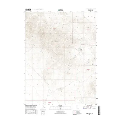
2017 Map of Tabbys Peak SW
USGS Topo · Published 2017About this map
Cedar Mountains dominate the western portion of this topographic survey, defining the high ground above the eastern flats of Skull Valley. The landscape is marked by essential water sources for the Great Basin, including Cane Springs, Old Springs, and Bitter Spring. This network of watering holes supported transit and ranching through the arid terrain long before modern infrastructure. On the eastern slopes, White Rock stands as a prominent landmark near White Rock Spring, where White Rock Spring Rd and Cochran Spring Rd intersect to provide access into the high country. To the southeast, the depression of Wide Hollow transitions the mountain topography toward the valley floor, illustrating the traditional routes and natural drainage patterns used by those navigating this part of Tooele County.
Find a feature on this map
16 named features on this map. Tap any name to fly to it.
Don’t see what you’re looking for? This feature index may not catch every label — zoom into the map to look around manually.
Map Details
Editions of this 2017 Tabbys Peak SW Map
This is the sole edition of this map. No revisions or reprints were ever made.
Other maps of this area

1885 · Tooele Valley
USGS Topo · 1:250,000

1953 · Tooele
USGS Topo · 1:250,000

1954 · Dugway Proving Ground NE
USGS Topo · 1:24,000

1954 · Camels Back Ridge NW
USGS Topo · 1:24,000

1955 · Tabbys Peak SE
USGS Topo · 1:24,000

1955 · Tabbys Peak
USGS Topo · 1:24,000

1955 · Camels Back Ridge NE
USGS Topo · 1:24,000

1955 · Wig Mtn
USGS Topo · 1:24,000

1955 · Wig Mtn NE
USGS Topo · 1:24,000

1955 · Tabbys Peak SW
USGS Topo · 1:24,000