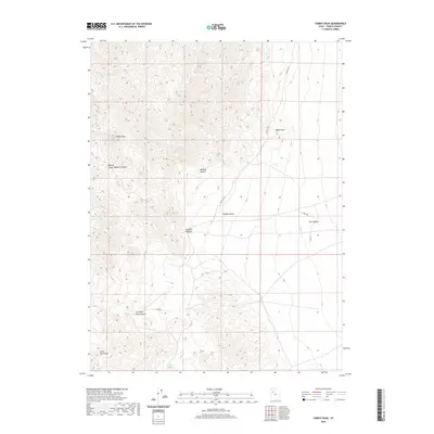
2020 Map of Tabbys Peak
USGS Topo · Published 2020About this map
Tabbys Peak stands as the primary landmark in this high-desert portion of the Cedar Mountains, overlooking the broad expanse of Skull Valley to the east. This 2020 survey reveals a landscape shaped by remote canyons and intermittent water sources, such as Tabbys Spring and Cochran Spring. The terrain is punctuated by significant passes, including Rydalch Pass and the evocatively named Six Horse Pass Canyon, which suggest historical transit routes through the range. Human presence is sparse, marked primarily by unpaved tracks like Rydalch Rd and Well Rd that navigate the slopes and basins. The transition from the steep elevation of Wildcat Canyon to the relatively flat basin floor illustrates the stark topography characteristic of Tooele County's interior ranges.
Find a feature on this map
15 named features on this map. Tap any name to fly to it.
Don’t see what you’re looking for? This feature index may not catch every label — zoom into the map to look around manually.
Map Details
Editions of this 2020 Tabbys Peak Map
This is the sole edition of this map. No revisions or reprints were ever made.
Other maps of this area

1885 · Tooele Valley
USGS Topo · 1:250,000

1953 · Tooele
USGS Topo · 1:250,000

1955 · Tabbys Peak SE
USGS Topo · 1:24,000

1955 · Tabbys Peak
USGS Topo · 1:24,000

1955 · Wig Mtn
USGS Topo · 1:24,000

1955 · Wig Mtn NE
USGS Topo · 1:24,000

1955 · Tabbys Peak SW
USGS Topo · 1:24,000

1955 · Tooele
USGS Topo · 1:250,000

1973 · Quincy Spring
USGS Topo · 1:24,000

1973 · Aragonite SE
USGS Topo · 1:24,000