
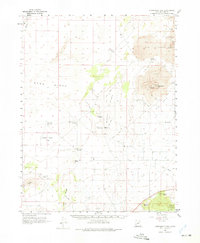
1962 Map of Tabernacle Hill
USGS Topo · Published 1963About this map
Volcanic geology dominates this western Utah landscape, where the Tabernacle Hill and Tabernacle Crater stand as prominent landmarks amidst the sprawling basalt flows of The Cinders. Mapped in the early 1960s, the area shows a precarious balance between arid desert terrain and vital water management. A network of Jeep Trails provides the only passage through the Sand Ridge and across the Beaver Ridge, connecting isolated water sources like Twin Peaks Spring and Squidike Spring.
Find a feature on this map
31 named features on this map. Tap any name to fly to it.
Don’t see what you’re looking for? This feature index may not catch every label — zoom into the map to look around manually.
Map Details
Editions of this 1962 Tabernacle Hill Map
2 editions found
Other maps of this area

1885 · Beaver
USGS Topo · 1:250,000

1885 · Sevier Desert
USGS Topo · 1:250,000

1932 · Sevier
USGS Topo · 1:62,500

1935 · Sevier
USGS Topo · 1:62,500

1953 · Richfield
USGS Topo · 1:250,000

1953 · Delta
USGS Topo · 1:250,000

1958 · Richfield
USGS Topo · 1:250,000

1958 · Delta
USGS Topo · 1:250,000

1960 · Meadow
USGS Topo · 1:24,000

1962 · Delta
USGS Topo · 1:250,000