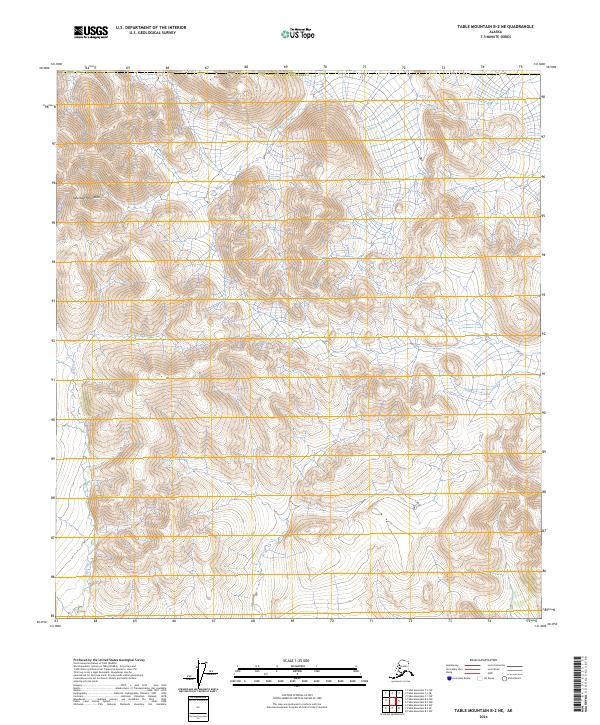
2024 Map of Table Mountain B-2 NE
USGS Topo · Published 2024About this map
Mollie Beattie Wilderness defines the interior landscape of this remote corner of the Arctic National Wildlife Refuge. The map captures a high-altitude wilderness where natural drainage patterns dictate the terrain, most notably the northward flow of the Firth River. This river corridor and its tributary, Lois Creek, represent the primary topographic breaks in a region characterized by steep elevation changes and unnamed peaks within the Yukon-Koyukuk Census Area. The absence of man-made infrastructure or named settlements underscore the primitive state of this protected ecosystem, where public land divisions like t11s r44e and t12s r45e provide the only formal human grid over the ancient geography.
Find a feature on this map
9 named features on this map. Tap any name to fly to it.
Don’t see what you’re looking for? This feature index may not catch every label — zoom into the map to look around manually.
Map Details
Editions of this 2024 Table Mountain B-2 NE Map
This is the sole edition of this map. No revisions or reprints were ever made.
Other maps of this area

1951 · Table Mountain
USGS Topo · 1:250,000

1956 · Table Mountain
USGS Topo · 1:250,000

1964 · Table Mountain
USGS Topo · 1:250,000
1972 · Table Mountain B-1
USGS Topo · 1:63,360
1972 · Table Mountain B-2
USGS Topo · 1:63,360
1983 · Table Mountain C-1
USGS Topo · 1:63,360
1983 · Table Mountain C-2
USGS Topo · 1:63,360
2018 · Table Mountain B-1 SW
USGS Topo · 1:25,000
2018 · Table Mountain C-2 SE
USGS Topo · 1:25,000
2018 · Table Mountain B-2 SW
USGS Topo · 1:25,000