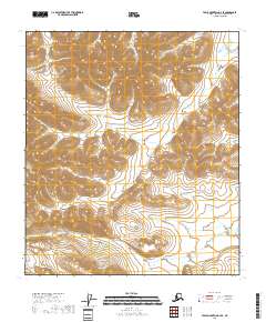
2018 Map of Table Mountain C-2 SE
USGS Topo · Published 2018About this map
High arctic drainage patterns define this portion of the Firth River corridor in the North Slope Borough. The terrain is characterized by steep contour intervals and the convergence of several township boundaries, including t11s r45e and t11s r44e, which demarcate the vast public lands managed by the Bureau of Land Management. The absence of roads, settlements, or structures emphasizes the remote nature of this Alaskan landscape as it remained in the early 21st century. The map provides a precise look at the seasonal flow and braided channels of the upper Firth River as it traverses the foothills of the Brooks Range.
Find a feature on this map
7 named features on this map. Tap any name to fly to it.
Don’t see what you’re looking for? This feature index may not catch every label — zoom into the map to look around manually.
Map Details
Editions of this 2018 Table Mountain C-2 SE Map
This is the sole edition of this map. No revisions or reprints were ever made.
Other maps of this area

1951 · Table Mountain
USGS Topo · 1:250,000

1956 · Table Mountain
USGS Topo · 1:250,000

1964 · Table Mountain
USGS Topo · 1:250,000
1972 · Table Mountain B-1
USGS Topo · 1:63,360
1972 · Table Mountain B-2
USGS Topo · 1:63,360
1983 · Table Mountain C-1
USGS Topo · 1:63,360
1983 · Table Mountain C-2
USGS Topo · 1:63,360
2018 · Table Mountain C-2 NE
USGS Topo · 1:25,000
2018 · Table Mountain C-1 NW
USGS Topo · 1:25,000
2018 · Table Mountain C-2 NW
USGS Topo · 1:25,000