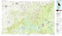
1985 Map of Table Rock Lake
USGS Topo · Published 1985About this map
Table Rock Lake and the winding White River valley define this Ozark landscape, which by the mid-1980s had become a major recreational hub. The map illustrates the complex interplay between the deep impoundments of the Table Rock Dam and older tourist destinations like Rockaway Beach and Silver Dollar City. While the southern half is dominated by the intricate shorelines and the Mark Twain National Forest, the northern portion reveals a transition to the agricultural and transit corridors of the Burlington Northern RR, connecting towns like Monett, Pierce City, and Aurora.
Find a feature on this map
130 named features on this map. Tap any name to fly to it.
Don’t see what you’re looking for? This feature index may not catch every label — zoom into the map to look around manually.
Map Details
Editions of this 1985 Table Rock Lake Map
This is the sole edition of this map. No revisions or reprints were ever made.
Other maps of this area

1884 · Springfield
USGS Topo · 1:125,000

1886 · Greenfield
USGS Topo · 1:125,000

1886 · Carthage
USGS Topo · 1:125,000

1886 · Springfield
USGS Topo · 1:125,000

1888 · Greenfield
USGS Topo · 1:125,000

1893 · Yellville
USGS Topo · 1:125,000

1894 · Carthage
USGS Topo · 1:125,000

1899 · Fayetteville
USGS Topo · 1:125,000

1900 · Eureka Springs
USGS Topo · 1:125,000

1901 · Eureka Springs
USGS Topo · 1:125,000