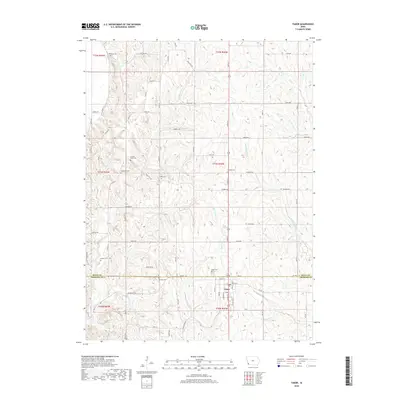
2018 Map of Tabor
USGS Topo · Published 2018About this map
Tabor sits at the intersection of the Fremont and Mills county line, serving as the primary hub for this rural landscape. The surrounding terrain is defined by a dense network of winding creeks and tributaries, including Waubonsie Cr, McPherron Cr, and Plum Cr, which carve through the loess hills typical of this region. The map reveals a land structured by the Public Land Survey System, with a regular grid of gravel and paved roads such as Mahaffey Rd and Quigg Ave providing access to outlying farms.
Find a feature on this map
62 named features on this map. Tap any name to fly to it.
Don’t see what you’re looking for? This feature index may not catch every label — zoom into the map to look around manually.
Map Details
Editions of this 2018 Tabor Map
This is the sole edition of this map. No revisions or reprints were ever made.
Other maps of this area

1935 · Nehawka
USGS Topo · 1:48,000

1940 · Nehawka
USGS Topo · 1:62,500

1954 · Omaha
USGS Topo · 1:250,000

1955 · Nebraska City
USGS Topo · 1:250,000

1956 · Glenwood
USGS Topo · 1:24,000

1956 · Rock Bluff
USGS Topo · 1:24,000

1956 · Pacific Junction
USGS Topo · 1:24,000

1956 · Malvern
USGS Topo · 1:24,000

1957 · Nebraska City
USGS Topo · 1:250,000

1957 · Omaha
USGS Topo · 1:250,000