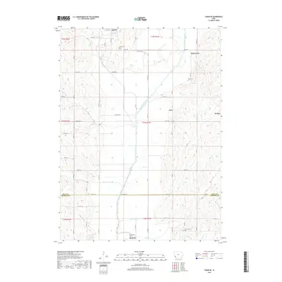
2018 Map of Tabor NE
USGS Topo · Published 2018About this map
The West Nishnabotna River carves a broad valley through the heart of this section of southwest Iowa, shaping the agricultural layout and road networks of Mills and Fremont Counties. The river is supplemented by several engineered and natural waterways, including the Kilpatrick Ditch and Spring Valley Cr, which manage the drainage of the fertile bottomlands. These water features are flanked by several small agricultural centers and communities, most notably Malvern at the northern edge and Randolph near the southern border. The landscape is characterized by a dense grid of rural roads like Waubonsie Ave and Lytle Ave, which connect isolated farmsteads to local landmarks. Genealogists will find particular value in the several documented burial sites situated on higher ground above the floodplains, including Malvern Cem, Parker Cem, and Riverside Cem.
Find a feature on this map
63 named features on this map. Tap any name to fly to it.
Don’t see what you’re looking for? This feature index may not catch every label — zoom into the map to look around manually.
Map Details
Editions of this 2018 Tabor NE Map
This is the sole edition of this map. No revisions or reprints were ever made.
Other maps of this area

1954 · Omaha
USGS Topo · 1:250,000

1955 · Nebraska City
USGS Topo · 1:250,000

1956 · Glenwood
USGS Topo · 1:24,000

1956 · Malvern
USGS Topo · 1:24,000

1957 · Nebraska City
USGS Topo · 1:250,000

1957 · Omaha
USGS Topo · 1:250,000

1957 · Randolph
USGS Topo · 1:24,000

1957 · Tabor
USGS Topo · 1:24,000

1957 · Tabor NE
USGS Topo · 1:24,000

1957 · Tabor SW
USGS Topo · 1:24,000