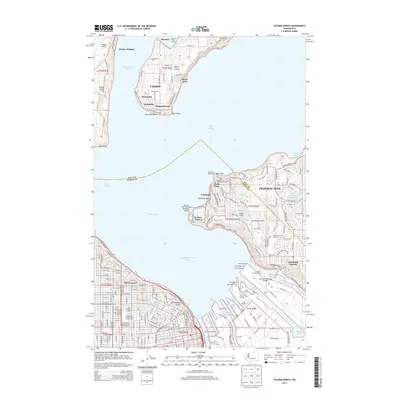
2014 Map of Tacoma North
USGS Topo · Published 2014About this map
Commencement Bay and the intricate industrial finger piers of the Port of Tacoma anchor the southern portion of this 2014 survey. The map details the transition from the dense urban grid of Old Tacoma and the campus of the University of Puget Sound to the maritime-focused communities of Vashon and Maury Island. These northern reaches, including Dockton and Manzanita, are defined by the complex shoreline of Quartermaster Harbor and landmarks such as the Penbrock Cem.
Find a feature on this map
84 named features on this map. Tap any name to fly to it.
Don’t see what you’re looking for? This feature index may not catch every label — zoom into the map to look around manually.
Map Details
Editions of this 2014 Tacoma North Map
This is the sole edition of this map. No revisions or reprints were ever made.
Other maps of this area

1897 · Tacoma
USGS Topo · 1:125,000

1900 · Tacoma
USGS Topo · 1:125,000

1940 · Anderson Island
USGS Topo · 1:62,500

1941 · Tacoma South
USGS Topo · 1:62,500

1942 · Gig Harbor
USGS Topo · 1:62,500

1943 · Gig Harbor
USGS Topo · 1:62,500

1944 · Tacoma South
USGS Topo · 1:62,500

1948 · Anderson Island
USGS Topo · 1:62,500

1948 · Steilacoom
USGS Topo · 1:24,000

1949 · Tacoma North
USGS Topo · 1:24,000