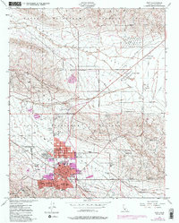
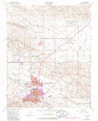
1950 Map of Taft
USGS Topo · Published 1986About this map
The Naval Petroleum Reserve No 1 and Naval Petroleum Reserve No 2 dominate this industrial landscape in Kern County, highlighting the region's central role in mid-century energy production. The concentrated urban centers of Taft, Ford City, and Taft Heights are surrounded by a dense network of extraction infrastructure, including numerous oil tanks, oil sumps, and pipelines. The presence of specialized housing like Standard Oil Camp 11-C and Honolulu Oil Main Camp illustrates the company-town architecture common to California's oil fields.
Find a feature on this map
44 named features on this map. Tap any name to fly to it.
Don’t see what you’re looking for? This feature index may not catch every label — zoom into the map to look around manually.
Map Details
Editions of this 1950 Taft Map
5 editions found
Other maps of this area

1910 · Buena Vista Lake
USGS Topo · 1:125,000

1912 · McKittrick
USGS Topo · 1:125,000

1912 · Buena Vista Lake
USGS Topo · 1:125,000

1929 · Coles Levee
USGS Topo · 1:31,680

1929 · Mouth of Kern
USGS Topo · 1:31,680

1931 · Pentland Junction
USGS Topo · 1:31,680

1932 · West Elk Hills
USGS Topo · 1:31,680

1932 · East Elk Hills
USGS Topo · 1:31,680

1932 · Mouth of Kern
USGS Topo · 1:31,680
1933 · Tupman
USGS Topo · 1:31,680