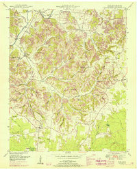
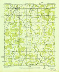
1951 Map of Taft
USGS Topo · Published 1967About this map
The Elk River winds through the northern portion of this Lincoln County survey, creating deep meanders like Hovis Bend and Sumners Bend. The landscape is defined by an intricate network of family-named hollows, including Robison Hollow, Stillhouse Hollow, and Bonner Hollow, which reveal the traditional settlement patterns of the Tennessee-Alabama borderlands. While Taft serves as a local hub near the Alabama state line, the map documents a decentralized community supported by institutions like Coldwater School, Marys Grove School, and numerous country churches such as Prosperity Ch. A notable landmark is the County Farm, situated near Potato Hill. Transportation is marked by early infrastructure, including Hobbs Bridge and a long-established telephone line, which follows the contours of the drainage basins between Coldwater Creek and the Flint River.
Find a feature on this map
66 named features on this map. Tap any name to fly to it.
Don’t see what you’re looking for? This feature index may not catch every label — zoom into the map to look around manually.
Map Details
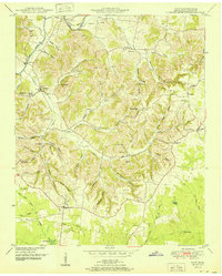
Editions of this 1951 Taft Map
2 editions found
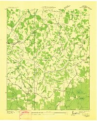
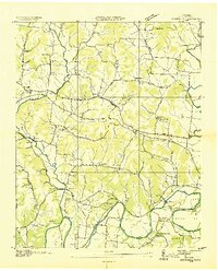
Other maps of this area

1888 · Huntsville
USGS Topo · 1:125,000

1892 · Huntsville
USGS Topo · 1:125,000
1936 · Taft
USGS Topo · 1:24,000

1936 · Fisk
USGS Topo · 1:24,000
1936 · Boonshill
USGS Topo · 1:24,000
1936 · Ardmore
USGS Topo · 1:24,000

1936 · Lincoln
USGS Topo · 1:24,000

1936 · Toney
USGS Topo · 1:24,000
1936 · Frankewing
USGS Topo · 1:24,000
1936 · Fayetteville
USGS Topo · 1:24,000