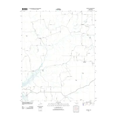
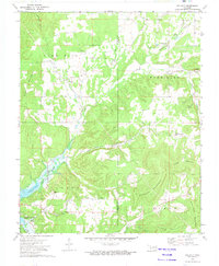
2012 Map of Tailholt
USGS Topo · Published 2012About this map
Tenkiller Lake dominates the southwestern corner of this Oklahoma landscape, where the waters of the Illinois River basin gather near the settlement of Barber. The area is defined by a series of prominent ridges and named depressions, including Sugar Mtn, Hungry Mtn, and the descriptively titled Negro Jake Hollow. Small residential clusters and historic points of interest like Wauhillau and Tailholt are connected by a network of rural roads such as Stone Point Rd and S Welling Rd. Genealogists will find significant value in the mapped locations of local burial grounds, including Stony Point Cem, Caney Cem, and Barber Cem, which anchor the history of these communities. Water remains a central theme across the quadrangle, with Caney Cr and Bidding Cr winding through the hollows, while Bitting Spring and July Spring provide natural landmarks in the northern reaches.
Find a feature on this map
81 named features on this map. Tap any name to fly to it.
Don’t see what you’re looking for? This feature index may not catch every label — zoom into the map to look around manually.
Map Details
Editions of this 2012 Tailholt Map
This is the sole edition of this map. No revisions or reprints were ever made.
Other maps of this area

1898 · Tahlequah
USGS Topo · 1:125,000

1901 · Tahlequah
USGS Topo · 1:125,000

1905 · Tahlequah
USGS Topo · 1:125,000

1946 · Fort Smith
USGS Topo · 1:250,000

1965 · Fort Smith
USGS Topo · 1:250,000

1967 · Fort Smith
USGS Topo · 1:250,000
1972 · Tahlequah
USGS Topo · 1:24,000
1972 · Christie
USGS Topo · 1:24,000
1972 · Stilwell West
USGS Topo · 1:24,000
1972 · Tailholt
USGS Topo · 1:24,000