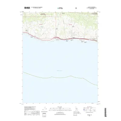
2018 Map of Tajiguas
USGS Topo · Published 2018About this map
The Los Padres National Forest meets the Santa Barbara coastline in this 2018 topographic study. The landscape is defined by steep canyons and drainage systems like Arroyo Quemado, Leon Canyon, and Aguajito Canyon that drop sharply toward the Pacific Ocean. These natural corridors dictate the path of infrastructure, with Cll Real and the coastal highway following the narrow terrace between the foothills and the surf. Settlement is concentrated in small coastal pockets such as Tajiguas, Refugio Beach, and Capitan.
Find a feature on this map
26 named features on this map. Tap any name to fly to it.
Don’t see what you’re looking for? This feature index may not catch every label — zoom into the map to look around manually.
Map Details
Editions of this 2018 Tajiguas Map
This is the sole edition of this map. No revisions or reprints were ever made.
Other maps of this area

1902 · Santa Ynez
USGS Topo · 1:125,000

1905 · Santa Ynez
USGS Topo · 1:125,000

1905 · Lompoc
USGS Topo · 1:125,000

1941 · San Rafael Mtn.
USGS Topo · 1:62,500

1942 · Lompoc
USGS Topo · 1:125,000

1942 · Gaviota
USGS Topo · 1:62,500

1942 · Goleta
USGS Topo · 1:62,500

1942 · San Rafael Mtn.
USGS Topo · 1:62,500

1942 · Los Olivos
USGS Topo · 1:62,500

1943 · San Rafael Mtn.
USGS Topo · 1:62,500