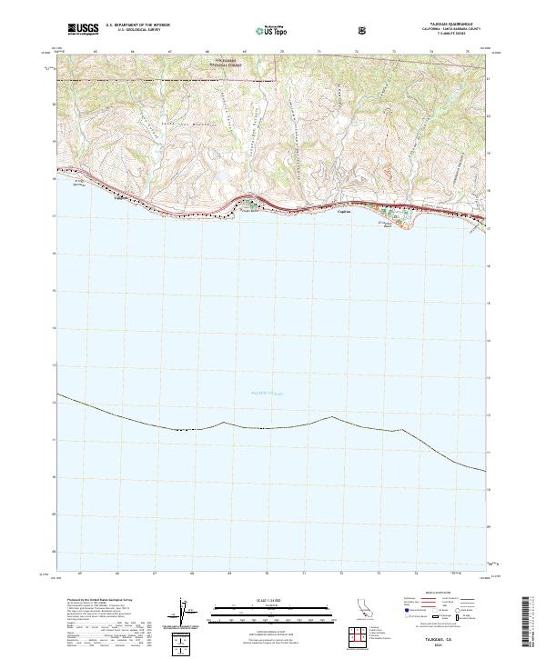
2021 Map of Tajiguas
USGS Topo · Published 2021About this map
The Santa Ynez Mountains rise sharply from the coastline of the Pacific Ocean, creating a narrow corridor where transportation and recreation converge. This 2021 study shows the rugged geography of the Los Padres National Forest meeting the shore at several coastal access points. Coastal settlements like Arroyo Quemado, Tajiguas, and Capitan are connected by historical routes like Cll Real and the modern Cal Coastal Trl. The landscape is deeply incised by numerous seasonal drainages, including Cañada Del Refugio and Cañada Del Corral, which flow southward through steep canyons. Public lands are prominent here, with both Refugio Beach and El Capitan Beach serving as primary landmarks for those exploring the edge of the Santa Barbara coast.
Find a feature on this map
38 named features on this map. Tap any name to fly to it.
Don’t see what you’re looking for? This feature index may not catch every label — zoom into the map to look around manually.
Map Details
Editions of this 2021 Tajiguas Map
This is the sole edition of this map. No revisions or reprints were ever made.
Other maps of this area

1902 · Santa Ynez
USGS Topo · 1:125,000

1905 · Santa Ynez
USGS Topo · 1:125,000

1905 · Lompoc
USGS Topo · 1:125,000

1941 · San Rafael Mtn.
USGS Topo · 1:62,500

1942 · Lompoc
USGS Topo · 1:125,000

1942 · Gaviota
USGS Topo · 1:62,500

1942 · Goleta
USGS Topo · 1:62,500

1942 · San Rafael Mtn.
USGS Topo · 1:62,500

1942 · Los Olivos
USGS Topo · 1:62,500

1943 · San Rafael Mtn.
USGS Topo · 1:62,500