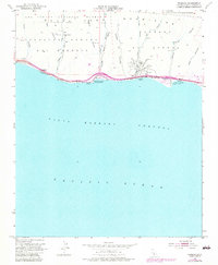
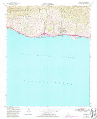
1953 Map of Tajiguas
USGS Topo · Published 1983About this map
Tajiguas Ranch and the coastal settlements of Tajiguas and Capitan anchor this mid-century survey of the Santa Barbara coastline. The landscape is defined by deep canyons such as Cañada del Refugio and Las Flores Canyon that cut through the Nuestra Señora Refugio and El Corral terrain toward the Santa Barbara Channel. Industrial activity is evident along the coast, where Oil Wells and an Oil Sump appear alongside the vital transportation corridor of the Southern Pacific railroad and Highway 101. This 1953 map, updated in the early 1980s, captures the shoreline's balance between resource extraction and public recreation, showing the established footprints of Refugio Beach State Park and El Capitan Beach State Park nestled at the mouths of their respective canyons.
Find a feature on this map
29 named features on this map. Tap any name to fly to it.
Don’t see what you’re looking for? This feature index may not catch every label — zoom into the map to look around manually.
Map Details
Editions of this 1953 Tajiguas Map
5 editions found
Other maps of this area

1902 · Santa Ynez
USGS Topo · 1:125,000

1905 · Santa Ynez
USGS Topo · 1:125,000

1905 · Lompoc
USGS Topo · 1:125,000

1941 · San Rafael Mtn.
USGS Topo · 1:62,500

1942 · Lompoc
USGS Topo · 1:125,000

1942 · Gaviota
USGS Topo · 1:62,500

1942 · Goleta
USGS Topo · 1:62,500

1942 · San Rafael Mtn.
USGS Topo · 1:62,500

1942 · Los Olivos
USGS Topo · 1:62,500

1943 · San Rafael Mtn.
USGS Topo · 1:62,500