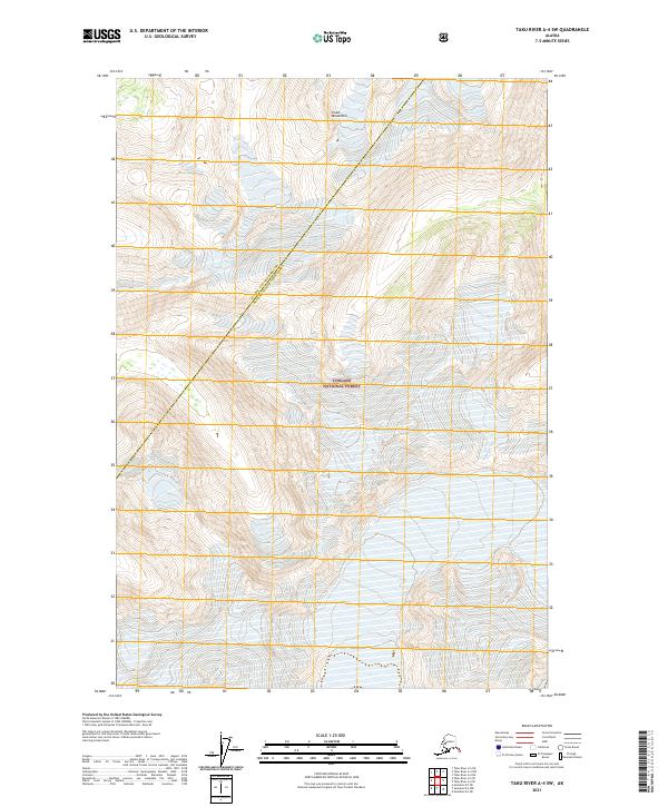
2021 Map of Taku River A-4 SW
USGS Topo · Published 2021About this map
Coast Mountains terrain dominates this 2021 survey, which illustrates a remote expanse of the Tongass National Forest. The map is centered on a high-elevation interior landscape where steep contours define unnamed peaks and ridgelines. A significant administrative boundary bisects the quadrangle diagonally, separating the Juneau City and Borough from the Hoonah-Angoon Census Area. This line serves as a key marker for researchers tracking jurisdictional divisions in this part of Southeast Alaska. Lacking roads or named settlements, the sheet provides a precise look at the township and range system, including t43s r74e and t44s r75e, making it a valuable tool for understanding the public land survey structure in an area characterized by deep snowfields and high-altitude wilderness.
Find a feature on this map
9 named features on this map. Tap any name to fly to it.
Don’t see what you’re looking for? This feature index may not catch every label — zoom into the map to look around manually.
Map Details
Editions of this 2021 Taku River A-4 SW Map
This is the sole edition of this map. No revisions or reprints were ever made.
Other maps of this area

1948 · Sumdum D-5
USGS Topo · 1:63,360

1951 · Taku River A-4
USGS Topo · 1:63,360

1951 · Taku River A-5
USGS Topo · 1:63,360

1952 · Sumdum
USGS Topo · 1:250,000

1953 · Taku River
USGS Topo · 1:250,000

1955 · Sumdum D-5
USGS Topo · 1:63,360

1960 · Taku River
USGS Topo · 1:250,000

1960 · Sumdum D-4
USGS Topo · 1:63,360

1961 · Sumdum
USGS Topo · 1:250,000
1994 · Sumdum D-5
USGS Topo · 1:63,360