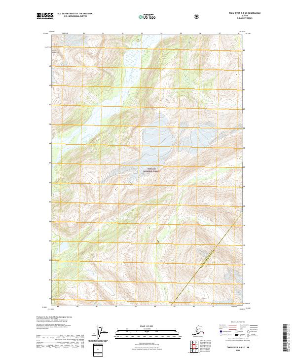
2021 Map of Taku River A-5 SE
USGS Topo · Published 2021About this map
The Whiting River winds through the glacially-carved valleys of the Coast Mountains in this 2021 survey of Southeast Alaska. This remote landscape is defined by its dramatic relief and is almost entirely contained within the Tongass National Forest, the nation's largest national forest. The map documents the administrative boundary between the Juneau City and Borough Hoonah-Angoon Census Area, tracing the high ridges that separate these jurisdictions. Surveyed by the U.S. Geological Survey using recent imagery and elevation datasets, the sheet illustrates the sheer rock faces and ice-fields of the high country alongside the river's lower riparian zones. It serves as a precise record of the hydrologic and topographic state of the Taku River region at the start of the 2020s.
Find a feature on this map
10 named features on this map. Tap any name to fly to it.
Don’t see what you’re looking for? This feature index may not catch every label — zoom into the map to look around manually.
Map Details
Editions of this 2021 Taku River A-5 SE Map
This is the sole edition of this map. No revisions or reprints were ever made.
Other maps of this area

1948 · Sumdum D-5
USGS Topo · 1:63,360

1951 · Taku River A-4
USGS Topo · 1:63,360

1951 · Taku River A-5
USGS Topo · 1:63,360

1952 · Sumdum
USGS Topo · 1:250,000

1953 · Taku River
USGS Topo · 1:250,000

1955 · Sumdum D-5
USGS Topo · 1:63,360

1960 · Taku River
USGS Topo · 1:250,000

1960 · Sumdum D-4
USGS Topo · 1:63,360

1961 · Sumdum
USGS Topo · 1:250,000
1994 · Sumdum D-5
USGS Topo · 1:63,360