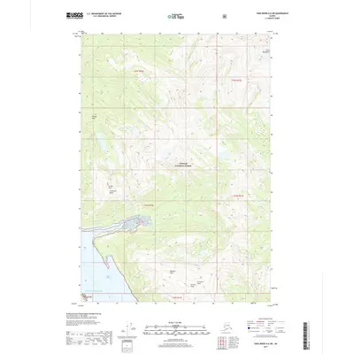
2017 Map of Taku River A-6 SW
USGS Topo · Published 2017About this map
Tongass National Forest dominates this coastal Alaska landscape, where the high summits of the Coast Mountains meet the waters of the Gulf of Alaska. The terrain is defined by dramatic elevation changes, rising from the tidal waters of Stephens Passage to prominent heights such as Steeple Peak and Arthur Peak. A notable geographical feature is the narrow Limestone Inlet, which carves into the shoreline beneath the steep Limestone Bluffs. This area, situated near the boundary of Juneau Borough, illustrates a wilderness largely untouched by modern road infrastructure, relying instead on waterways like Limestone Cr and Prospect Cr for natural navigation. Researchers of maritime history and topographic evolution can trace the complex shoreline where glacial valleys meet the sea, while prominent landmarks like Everett Peak and Fillmore Peak serve as primary navigational anchors for the region.
Find a feature on this map
20 named features on this map. Tap any name to fly to it.
Don’t see what you’re looking for? This feature index may not catch every label — zoom into the map to look around manually.
Map Details
Editions of this 2017 Taku River A-6 SW Map
This is the sole edition of this map. No revisions or reprints were ever made.
Other maps of this area

1948 · Sitka D-1
USGS Topo · 1:63,360

1948 · Sumdum D-6
USGS Topo · 1:63,360

1951 · Juneau
USGS Topo · 1:250,000

1951 · Taku River A-6
USGS Topo · 1:63,360

1951 · Sitka
USGS Topo · 1:250,000

1951 · Juneau A-1
USGS Topo · 1:63,360

1951 · Sitka D-1
USGS Topo · 1:63,360

1951 · Sumdum D-6
USGS Topo · 1:63,360

1952 · Sumdum
USGS Topo · 1:250,000

1952 · Sitka
USGS Topo · 1:250,000