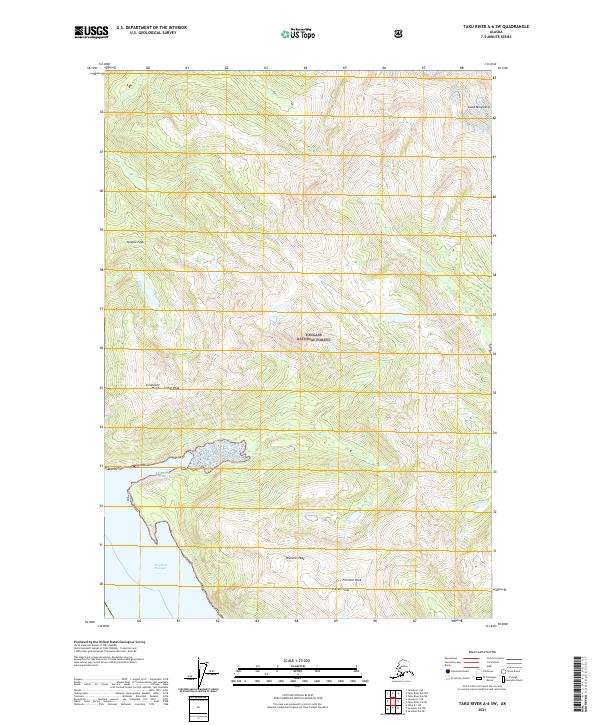
2021 Map of Taku River A-6 SW
USGS Topo · Published 2021About this map
Tongass National Forest dominates this coastal Alaska landscape, where the high peaks of the Coast Mountains meet the waters of Steph Passage. The topography is defined by significant elevations, including the sharp rise of Steeple Peak and the cluster of Webster Peak, Fillmore Peak, and Everett Peak in the south. These mountain masses are carved by glacial and fluvial action, evidenced by the drainage patterns of Prospect Cr and Limestone Cr.
Find a feature on this map
19 named features on this map. Tap any name to fly to it.
Don’t see what you’re looking for? This feature index may not catch every label — zoom into the map to look around manually.
Map Details
Editions of this 2021 Taku River A-6 SW Map
This is the sole edition of this map. No revisions or reprints were ever made.
Other maps of this area

1948 · Sitka D-1
USGS Topo · 1:63,360

1948 · Sumdum D-6
USGS Topo · 1:63,360

1951 · Juneau
USGS Topo · 1:250,000

1951 · Taku River A-6
USGS Topo · 1:63,360

1951 · Sitka
USGS Topo · 1:250,000

1951 · Juneau A-1
USGS Topo · 1:63,360

1951 · Sitka D-1
USGS Topo · 1:63,360

1951 · Sumdum D-6
USGS Topo · 1:63,360

1952 · Sumdum
USGS Topo · 1:250,000

1952 · Sitka
USGS Topo · 1:250,000