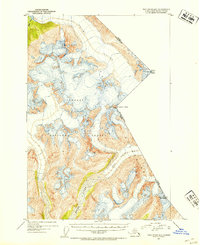
1951 Map of Taku River B-5
USGS Topo · Published 1954About this map
Tongass National Forest dominates this mid-century topographic record, capturing a landscape of massive ice fields and high-altitude peaks along the international border. The survey details the complex glacial systems of the Coast Mountains, where the massive Wright Glacier and the headwaters of the Speel River flow through an uninhabited wilderness. This 1951 study focuses on the intricate topographic relief of the Alaska-British Columbia boundary, marking specific surveyor points such as Mount Ogden, Mt Brundage, and Boundary Peak 95 (Mt Fremont Morse). The map provides a precise look at the drainage patterns of Hidden Creek and the surrounding permanent snowfields before the era of modern glacial recession, making it a critical document for understanding the geographic state of the Alaska Panhandle's backcountry during the early Cold War era.
Find a feature on this map
11 named features on this map. Tap any name to fly to it.
Don’t see what you’re looking for? This feature index may not catch every label — zoom into the map to look around manually.
Map Details
Editions of this 1951 Taku River B-5 Map
4 editions found
Other maps of this area

1951 · Taku River A-4
USGS Topo · 1:63,360

1951 · Taku River B-6
USGS Topo · 1:63,360

1951 · Taku River A-5
USGS Topo · 1:63,360

1951 · Taku River A-6
USGS Topo · 1:63,360

1951 · Taku River B-5
USGS Topo · 1:63,360

1953 · Taku River
USGS Topo · 1:250,000
1960 · Taku River C-5
USGS Topo · 1:63,360

1960 · Taku River C-6
USGS Topo · 1:63,360

1960 · Taku River
USGS Topo · 1:250,000

1994 · Taku River B-6
USGS Topo · 1:63,360