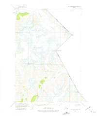
1951 Map of Taku River B-5
USGS Topo · Published 1975About this map
The international border between British Columbia and the City and Borough of Juneau cuts through this high-elevation wilderness in the early 1950s. The landscape is defined by massive ice fields and the movement of the Wright Glacier and Speel Glacier. This survey, based on 1948 aerial photography, shows the drainage of Speel River as it winds through the Tongass National Forest. Prominent peaks like Mount Ogden, Mt Fremont Morse, and Mt Brundage mark the rugged boundary line between the United States and Canada. Small water bodies such as Speel Lake and Hidden Creek are nestled in the valleys, illustrating the complex hydrology of this roadless region before modern development. The map serves as a primary record of glacial extent and alpine topography at the mid-century mark.
Find a feature on this map
12 named features on this map. Tap any name to fly to it.
Don’t see what you’re looking for? This feature index may not catch every label — zoom into the map to look around manually.
Map Details
Editions of this 1951 Taku River B-5 Map
4 editions found
Other maps of this area

1951 · Taku River A-4
USGS Topo · 1:63,360

1951 · Taku River B-6
USGS Topo · 1:63,360

1951 · Taku River A-5
USGS Topo · 1:63,360

1951 · Taku River A-6
USGS Topo · 1:63,360

1951 · Taku River B-5
USGS Topo · 1:63,360

1953 · Taku River
USGS Topo · 1:250,000
1960 · Taku River C-5
USGS Topo · 1:63,360

1960 · Taku River C-6
USGS Topo · 1:63,360

1960 · Taku River
USGS Topo · 1:250,000

1994 · Taku River B-6
USGS Topo · 1:63,360