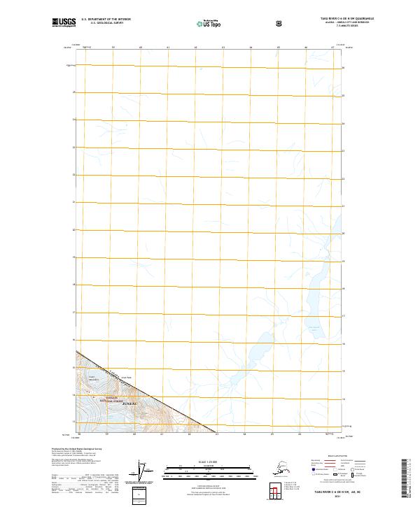
2021 Map of Taku River C-6 OE N SW
USGS Topo · Published 2021About this map
Tulsequah Lake and the high ridges of the Coast Mountains dominate this remote landscape along the international boundary in 2021. Situated within the Tongass National Forest, the terrain is defined by extreme elevations and glacial features, including the prominent summit of Gisel Peak. The map documents the precise interface between the United States and Canada, where the jurisdictional boundary follows the height of land across these ice-bound massifs. This survey provides a definitive record of the hydrological and topographic character of the region as it exists in the early twenty-first century, showing the complex drainage patterns feeding into the Tulsequah system.
Find a feature on this map
6 named features on this map. Tap any name to fly to it.
Don’t see what you’re looking for? This feature index may not catch every label — zoom into the map to look around manually.
Map Details
Editions of this 2021 Taku River C-6 OE N SW Map
This is the sole edition of this map. No revisions or reprints were ever made.
Other maps of this area

1951 · Juneau
USGS Topo · 1:250,000

1953 · Taku River
USGS Topo · 1:250,000

1960 · Taku River C-6
USGS Topo · 1:63,360

1960 · Juneau D-1
USGS Topo · 1:63,360

1960 · Juneau C-1
USGS Topo · 1:63,360

1960 · Taku River
USGS Topo · 1:250,000

1962 · Juneau
USGS Topo · 1:250,000

1995 · Taku River C-6
USGS Topo · 1:63,360
2017 · Taku River C-6 NE
USGS Topo · 1:25,000
2017 · Juneau D-1 SE
USGS Topo · 1:25,000