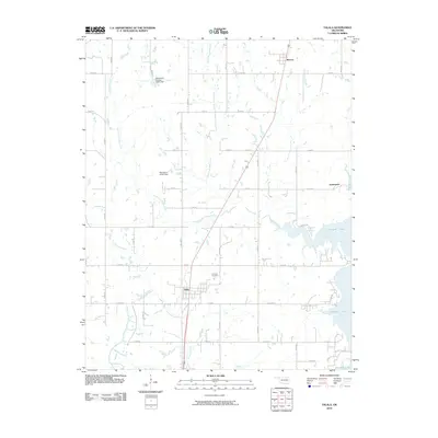
2010 Map of Talala
USGS Topo · Published 2010About this map
Talala and Watova anchor this Rogers County landscape, where the prairie grid meets the encroaching waters of the Verdigris River valley. The eastern edge of the quadrangle is defined by the irregular shoreline of Oologah Lake, a significant reservoir that reshaped the local geography and submerged the lower reaches of Talala Creek. The inland terrain is drained by the North Fork Talala Creek and South Fork Talala Creek, with several small impoundments like Oknoname 131011 Dam managing local runoff. Transportation in the area is dominated by the north-south corridor of S Hwy 169, which bypasses the older settlement of Jamestown to the east. For genealogists and local historians, the Fair View Cemetery serves as a central landmark just north of the Talala townsite, providing a fixed point of reference amid the modern township and range road network.
Find a feature on this map
38 named features on this map. Tap any name to fly to it.
Don’t see what you’re looking for? This feature index may not catch every label — zoom into the map to look around manually.
Map Details
Editions of this 2010 Talala Map
This is the sole edition of this map. No revisions or reprints were ever made.
Other maps of this area

1901 · Claremore
USGS Topo · 1:125,000

1901 · Nowata
USGS Topo · 1:125,000

1914 · Nowata
USGS Topo · 1:125,000

1914 · Claremore
USGS Topo · 1:125,000

1916 · Claremore
USGS Topo · 1:125,000

1954 · Tulsa
USGS Topo · 1:250,000

1958 · Tulsa
USGS Topo · 1:250,000

1959 · Collinsville NE
USGS Topo · 1:24,000

1963 · Tulsa
USGS Topo · 1:250,000

1970 · Bartlesville SE
USGS Topo · 1:24,000