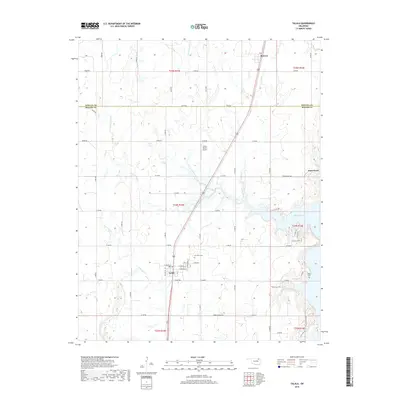
2019 Map of Talala
USGS Topo · Published 2019About this map
Talala serves as the primary hub of this Rogers County landscape, situated along a prominent north-south transit corridor. The settlement is characterized by a grid of local streets including W Watova St and E Sequoyah St, while the community of Sunnyside lies just to the south. The surrounding terrain is defined by the drainage basins of the N Fork Talala Cr and S Fork Talala Cr, which converge as they flow toward the southeastern corner of the map.
Find a feature on this map
43 named features on this map. Tap any name to fly to it.
Don’t see what you’re looking for? This feature index may not catch every label — zoom into the map to look around manually.
Map Details
Editions of this 2019 Talala Map
This is the sole edition of this map. No revisions or reprints were ever made.
Other maps of this area

1901 · Claremore
USGS Topo · 1:125,000

1901 · Nowata
USGS Topo · 1:125,000

1914 · Nowata
USGS Topo · 1:125,000

1914 · Claremore
USGS Topo · 1:125,000

1916 · Claremore
USGS Topo · 1:125,000

1954 · Tulsa
USGS Topo · 1:250,000

1958 · Tulsa
USGS Topo · 1:250,000

1959 · Collinsville NE
USGS Topo · 1:24,000

1963 · Tulsa
USGS Topo · 1:250,000

1970 · Bartlesville SE
USGS Topo · 1:24,000