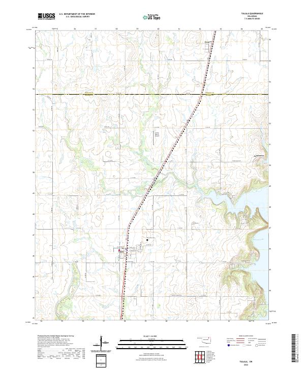
2022 Map of Talala
USGS Topo · Published 2022About this map
The town of Talala serves as the focal point of this northeastern Oklahoma landscape, situated where the northern edge of Rogers County meets the southern border of Nowata County. The area’s geography is defined by the headwaters of the Verdigris River watershed, including N Fork Talala Cr, S Fork Talala Cr, and Fourmile Cr. To the southeast, the terrain transitions into the indented shoreline of Oologah Lake, where several local roads such as S Talala Creek Ln and Goose Island Rd serve the lakeside area. Local history is anchored at the Fair View Cem northeast of the main town site, while the small settlement of Watova appears near the northern map edge. The grid of section roads highlights the rural agricultural character of the region, punctuated by private landmarks like the Lariat Ranch Airport and the crossroads at Jamestown.
Find a feature on this map
52 named features on this map. Tap any name to fly to it.
Don’t see what you’re looking for? This feature index may not catch every label — zoom into the map to look around manually.
Map Details
Editions of this 2022 Talala Map
This is the sole edition of this map. No revisions or reprints were ever made.
Other maps of this area

1901 · Claremore
USGS Topo · 1:125,000

1901 · Nowata
USGS Topo · 1:125,000

1914 · Nowata
USGS Topo · 1:125,000

1914 · Claremore
USGS Topo · 1:125,000

1916 · Claremore
USGS Topo · 1:125,000

1954 · Tulsa
USGS Topo · 1:250,000

1958 · Tulsa
USGS Topo · 1:250,000

1959 · Collinsville NE
USGS Topo · 1:24,000

1963 · Tulsa
USGS Topo · 1:250,000

1970 · Bartlesville SE
USGS Topo · 1:24,000