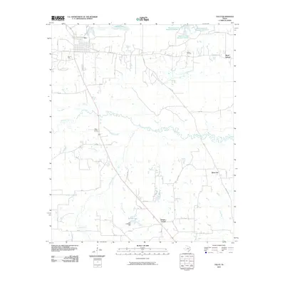
2010 Map of Talco
USGS Topo · Published 2010About this map
Talco and its surrounding countryside in Titus County are defined by a complex network of ranch roads and water management features. The landscape is dominated by the winding path of White Oak Creek and the industrial presence of the Talco Oil Field, which sits just southwest of the main town site. Agricultural and recreational heritage is evident at the Talco Rodeo Ground and the cluster of reservoirs to the northeast, including Blackmon Farms Reservoir Number 1. Small rural communities and historical nodes like Maple Springs and Bridges Chapel provide significant points of interest for local history, while the Belcher Cemetery serves as a vital anchor for genealogical research. The map illustrates a contemporary Texas landscape where water resources like John E Baldwin Lake and Prairie Lake support both local infrastructure and the broader drainage systems of Ripley Creek and McCullough Creek.
Find a feature on this map
49 named features on this map. Tap any name to fly to it.
Don’t see what you’re looking for? This feature index may not catch every label — zoom into the map to look around manually.
Map Details
Editions of this 2010 Talco Map
This is the sole edition of this map. No revisions or reprints were ever made.
Other maps of this area

1953 · Texarkana
USGS Topo · 1:250,000

1956 · Texarkana
USGS Topo · 1:250,000

1964 · Mount Vernon
USGS Topo · 1:24,000

1964 · Cuthand
USGS Topo · 1:24,000

1964 · Wilkinson
USGS Topo · 1:24,000

1964 · Talco
USGS Topo · 1:24,000

1964 · Hagansport
USGS Topo · 1:24,000

1964 · Bogata
USGS Topo · 1:24,000

1965 · Winfield
USGS Topo · 1:24,000

1965 · Mount Pleasant
USGS Topo · 1:24,000