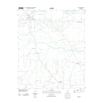
2013 Map of Talco
USGS Topo · Published 2013About this map
Talco sits at the northern edge of this Northeast Texas landscape, defined by its relationship to the Talco Oil Field and the meandering path of White Oak Cr. The map shows a region shaped by both industry and the low-lying wetlands of the White Oak Creek basin, where tributaries like Ripley Cr and Big Slough drain into the primary waterway. Small settlements and named locales such as Bridges Chapel, Maple Springs, and White Oak are scattered across the terrain, connected by a network of farm-to-market and county roads. Near the town center, the Talco Rodeo Ground and local street names like N Broad St and Crawford St provide specific geographic points for local history. To the north, a series of reservoirs including Blackmon Farms Reservoir Number 1 and Prairie Lake indicate managed water resources for agriculture and local use.
Find a feature on this map
71 named features on this map. Tap any name to fly to it.
Don’t see what you’re looking for? This feature index may not catch every label — zoom into the map to look around manually.
Map Details
Editions of this 2013 Talco Map
This is the sole edition of this map. No revisions or reprints were ever made.
Other maps of this area

1953 · Texarkana
USGS Topo · 1:250,000

1956 · Texarkana
USGS Topo · 1:250,000

1964 · Mount Vernon
USGS Topo · 1:24,000

1964 · Cuthand
USGS Topo · 1:24,000

1964 · Wilkinson
USGS Topo · 1:24,000

1964 · Talco
USGS Topo · 1:24,000

1964 · Hagansport
USGS Topo · 1:24,000

1964 · Bogata
USGS Topo · 1:24,000

1965 · Winfield
USGS Topo · 1:24,000

1965 · Mount Pleasant
USGS Topo · 1:24,000