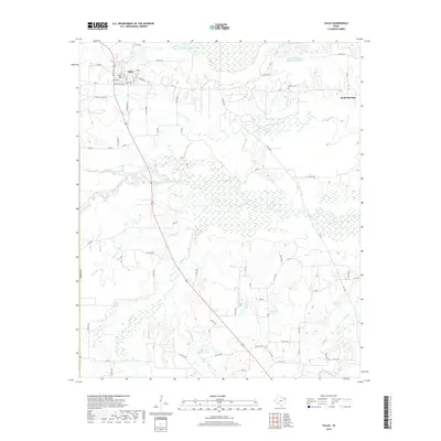
2019 Map of Talco
USGS Topo · Published 2019About this map
Talco sits at the intersection of local routes in northwestern Titus County, serving as a hub for the surrounding ranching and agricultural land. The town's grid, including W Crawford Ave and Lide St, gives way to a landscape defined by an intricate network of waterways and drainage basins. To the south, the terrain becomes increasingly marshy as Big Slough and White Oak Creek weave through the bottomlands, creating a distinct topographical divide between the upland settlements and the low-lying creek valleys.
Find a feature on this map
60 named features on this map. Tap any name to fly to it.
Don’t see what you’re looking for? This feature index may not catch every label — zoom into the map to look around manually.
Map Details
Editions of this 2019 Talco Map
This is the sole edition of this map. No revisions or reprints were ever made.
Other maps of this area

1953 · Texarkana
USGS Topo · 1:250,000

1956 · Texarkana
USGS Topo · 1:250,000

1964 · Mount Vernon
USGS Topo · 1:24,000

1964 · Cuthand
USGS Topo · 1:24,000

1964 · Wilkinson
USGS Topo · 1:24,000

1964 · Talco
USGS Topo · 1:24,000

1964 · Hagansport
USGS Topo · 1:24,000

1964 · Bogata
USGS Topo · 1:24,000

1965 · Winfield
USGS Topo · 1:24,000

1965 · Mount Pleasant
USGS Topo · 1:24,000