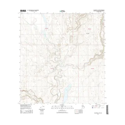
2016 Map of Talkeetna A-2 NW
USGS Topo · Published 2016About this map
The Kahiltna River snakes through this glacial landscape within the t25n r9w and t24n r9w townships, showing the complex braided and meandering patterns typical of the Matanuska-Susitna region. Near the eastern boundary, the settlement of Petersville sits above the valley of Bear Cr, serving as a focal point in a territory otherwise dominated by water systems. The map captures the significant drainage network of Peters Creek, which feeds into the larger river system, alongside notable water bodies such as Shulin Lake and the winding Lake Creek. These features illustrate the hydrologic connectivity of the area, where smaller tributaries like Treasure Creek and Shovel Cr contribute to the massive Kahiltna basin. The terrain is defined by a dense network of seasonal wetlands and shifting river channels that dictate the layout of the local landscape.
Find a feature on this map
12 named features on this map. Tap any name to fly to it.
Don’t see what you’re looking for? This feature index may not catch every label — zoom into the map to look around manually.
Map Details
Editions of this 2016 Talkeetna A-2 NW Map
This is the sole edition of this map. No revisions or reprints were ever made.
Other maps of this area

1950 · Talkeetna
USGS Topo · 1:250,000

1951 · Talkeetna
USGS Topo · 1:250,000

1954 · Talkeetna A-3
USGS Topo · 1:63,360

1954 · Talkeetna A-2
USGS Topo · 1:63,360

1954 · Talkeetna B-3
USGS Topo · 1:63,360

1954 · Talkeetna B-2
USGS Topo · 1:63,360

1958 · Talkeetna
USGS Topo · 1:250,000

1965 · Talkeetna
USGS Topo · 1:250,000
1994 · Talkeetna B-2
USGS Topo · 1:63,360
1994 · Talkeetna A-2
USGS Topo · 1:63,360