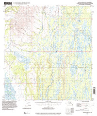
1994 Map of Talkeetna B-2
USGS Topo · Published 2000About this map
Peters Hills and the Little Peters Hills dominate the western landscape of this quadrangle, where a legacy of resource extraction is evident along the watercourses. Extensive Placer Mines and significant Dredge Tailings line the banks of Cache Creek and Peters Creek, marking the industrial footprint of gold seeking in the region. The small settlement of Petersville serves as the primary human landmark, supported by a Landing Strip and a network of Cabins scattered near the hills.
Find a feature on this map
46 named features on this map. Tap any name to fly to it.
Don’t see what you’re looking for? This feature index may not catch every label — zoom into the map to look around manually.
Map Details
Editions of this 1994 Talkeetna B-2 Map
This is the sole edition of this map. No revisions or reprints were ever made.
Other maps of this area

1950 · Talkeetna
USGS Topo · 1:250,000

1951 · Talkeetna
USGS Topo · 1:250,000

1951 · Talkeetna B-1
USGS Topo · 1:63,360

1951 · Talkeetna C-1
USGS Topo · 1:63,360

1952 · Talkeetna A-1
USGS Topo · 1:63,360

1954 · Talkeetna A-3
USGS Topo · 1:63,360

1954 · Talkeetna A-2
USGS Topo · 1:63,360

1954 · Talkeetna B-3
USGS Topo · 1:63,360

1954 · Talkeetna B-2
USGS Topo · 1:63,360

1958 · Talkeetna B-1
USGS Topo · 1:63,360